On October 8, the Clatsop County Commissioners unanimously adopted updates to the County's comprehensive plan to reflect modern needs for managing the areas beaches, dunes and coastal development, particularly in the face of environmental challenges like sea level rise and coastal erosion. As climate impacts accelerate, the County’s leadership in updating the plan sets a meaningful precedent for protecting public beaches, coastal ecosystems, and the communities that depend on them. The final language reflects a clear understanding of the challenges facing Oregon’s beaches and dunes and a strong commitment to protecting public access to and along the shoreline.
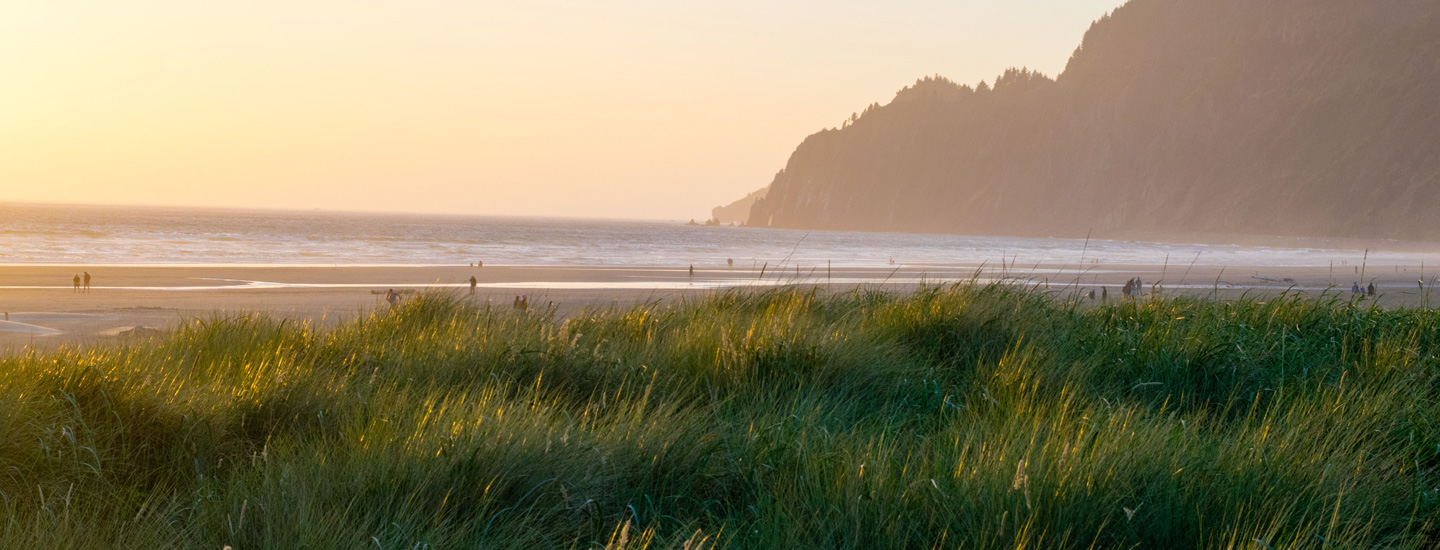
Oregon's wide sandy beaches and our public access to and along the ocean shore is a careful land use balance - requiring thoughtful science and proactive management to maintain this recreational birthright of Oregonians.
For the last five years, Clatsop County has been updating their comprehensive plan for Statewide Planning Goals 16-18 - key land use direction for coastal development and associated uses around estuaries, shorelines, beaches and dunes. The County worked with the Columbia River Estuary Study Task Force (CREST) to lead a local Technical Advisory Committee that Surfrider among other local groups, citizens, state agencies and stakeholders have been able to participate in. The recently adopted updates aligns county policies with Oregon’s Statewide Planning Goal 18 and introduces new policies on issues such as cable landings, shoreline protective structures, and sea level rise. The process used the latest 2025 mapping data and science from the State's Dept. of Geology and Mineral Industries (DOGAMI) to inform these updates, a major improvement in best available information for planning. The changes also require updates to zoning codes, specifically to enhance safety and environmental protection in oceanfront areas.
 A snapshot from the county's updated Shoreline Access Inventory. These inventories support planning for future and maintaining public beach access points, particularly in non-park and local community beach access areas.
Importantly for the public, the update includes a new Shoreline Access Inventory map, developed with state grant support, to ensure continued public access to beaches, rivers, and lakes. Digitized versions of long-standing maps—such as dune overlays and construction setback lines—will also now be publicly accessible through the County's WebMaps application, increasing transparency and ease of access. Community involvement has been key throughout the process, including multiple public meetings and input from the technical advisory committee over the years. These updates aim to balance recreational access with responsible coastal development and environmental protection in the face of climate change.
The unanimous County decision and final language marks a major milestone and victory in our Protect Clatsop Beaches campaign. Campaigns like this to update local comprehensive plans to better adapt to climate change and coastal hazards is a key campaign strategy in our broader Oregon Beaches Forever efforts. This is our most proactive opportunity to protect our state's treasured beaches, both in areas developed and relatively undeveloped. In particular, we celebrate the inclusion of language changes that support access for all (not just “necessary”) public access, the addition of language to protect access along the shore, improved geologic standards and stronger public engagement provisions throughout the process.
 As a founding member of the Newport, OR Chapter, Charlie has greatly advanced Surfrider's mission through ocean conservation as the Oregon Policy Manager. With a BS in Marine Biology and as a member of the Oregon Ocean Policy Advisory Council, Charlie’s ties to the ocean reach far and wide.